
In the forty years I have taught college students about Florida, there are some facts and information that always surprise the students. Here are some things that most Floridians are ignorant of or have a false impression.
Florida Was Once Africa
Geologists studying Florida’s ancient rock well beneath the surface can verify that millions of years ago when the ancient super-continents split apart, collided, and even rifted again, a section of the northwest African coast became attached to North America. Long before West Africans arrived on these shores, a piece of their native homeland was waiting for their arrival – that piece was Florida.

Contrary to Most Almanacs – Florida Is The Biggest
Most almanacs list Georgia as the largest state east of the Mississippi with Florida second. Due to Georgia’s rectangular shape and Florida’s thinner design, most people will accept that information on “face value.”
In actuality Georgia is just the Eastern state with the most land area (57,906.14 square miles) followed by Wisconsin’s 54,310.10 square miles and Florida’s 53,926.82 square miles. But this figure does NOT include lakes and rivers inside the states. When you add the water: Florida leads with 65,754.59 square miles, followed by Wisconsin’s 65,497.82, and Georgia’s 59,424.77 square miles.

Lake Okeechobee Is Ocean-like and Dangerous In Storms
If you don’t think adding water is important, I suggest you drive around Florida’s largest lake Lake Okeechobee.
The St Johns and the Nile Are Not Alone
Someone obviously from Northeast Florida has drilled it into the head that Florida’s longest river, the St. Johns, and the Nile are the only rivers that flow north. I guess that makes sense to people because on a map gravity tells you rivers can’t go northward.

How silly! The elevation of the terrain, no matter how minor, shapes the direction of a river. There are at least 225 rivers going north around the world. The Bighorn River in Wyoming and Montana at 461 miles is the longest north flowing river in the USA.
But don’t feel badly about this Northeast Floridians for the 310 mile St. Johns River is unique in many ways. It starts at an elevation of just 24 feet above sea level and slowly flows northward in many areas almost next to the coastline before it reaches the Atlantic Ocean northeast of Jacksonville. Try to find another river that does that trick!
Florida Is Huge Thanks To Its Shape And Water
Driving from Pensacola to Key West on the route suggested by AAA will take you 831 miles and over twelve hours. Going from New York City to Chicago via I-80 West is just 789.1 miles.

Don’t Expect a Divided Six Lane Highway To Key West
Florida Shares Something with the USA That Other States Lack
Much of the history of the United States was going westward to the Pacific. Today the United States is a two coast country with the Atlantic Ocean and the Pacific Ocean. Florida is the only state in the nation with two coastlines – the Atlantic Ocean and the Gulf of Mexico.
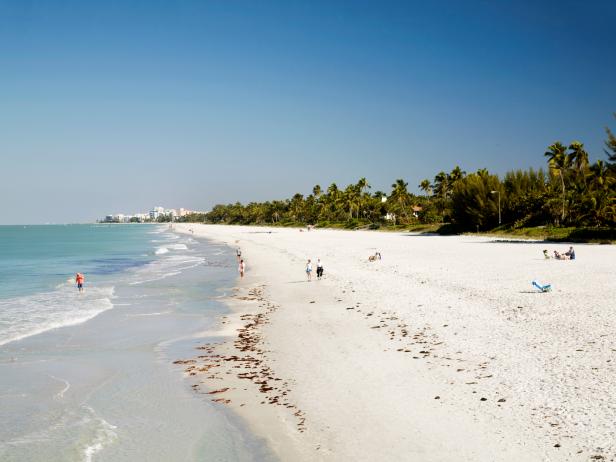
Naples Is Near The Gulf Beach Tip
No place in Florida is further than ninety miles from the ocean. Florida’s coastline of 1,350 miles is second only to gigantic Alaska and much bigger than California’s third place at 840 miles of coastline. Hawaii is 750 miles of coastline.

very interesting 🙂 Alaska also has 2 coasts – Berring Sea and Gulf of Alaska
LikeLike